Smoke plumes Type

Photographic Interpretation Guide
Smoke Plume Types
© It is not permitted to export, utilize and publish anyphotographs without the written permission of the GFMC. This includes the photos taken bythird parties.
![]()
1
 Smoke plumes and fire scars observed from the Space Shuttle and documented with a Hasselblad camera. The photograph shows a nadir view of the Zambezi River mouth, Mozambique, in 1984. Large areas of the fire scars (black) are obscured by the smoke plumes driven by easterly winds towards the interior of the African continent. Photo: Courtesy NASA (STS 41G-46-015). 2
  Smoke plumes and fire scars observed from the Space Shuttle and documented with a Hasselblad camera. The photograph shows a nadir view of the Zambezi River mouth, Mozambique, in 1984. Large areas of the fire scars (black) are obscured by the smoke plumes driven by easterly winds towards the interior of the African continent. Photo: Courtesy NASA (STS 41G-46-015). 3
  Brazilian land-clearing fires as seen from the Space Shuttle in 1991. In this situation of low- to no-wind conditions, high-intensity fires develop strong convective activities and produce single plumes which are injected into the upper troposphere.Photo: Courtesy NASA (STS S46-102-039). 4
  Los Alamos Fires From Landsat 7
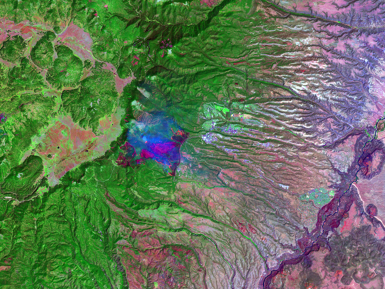
On 9 May 2000, the Landsat 7 satellite acquired two images of the area around Los Alamos, New Mexico. These images were acquired from 427 miles in space through its sensor called the Enhanced Thematic Mapper Plus (ETM+). Evident within the imagery is a view of the ongoing Cerro Grande fire near the town of Los Alamos and the Los Alamos National Laboratory.
(Source: Earth Observatory, NASA) 5
 6
6  GOES-10 Images Los Alamos Fires
A prescribed fire spread out of control near Los Alamos, New Mexico. Extreme fire behavior with high winds fanned the flames into Los Alamos Canyon on Wednesday, 10 May 2000. The GOES-10 image shows the effect the 60-mile-per-hour winds had in helping intensify the fire and spread the smoke plume eastward across New Mexico and into northern Texas and the Oklahoma panhandle.
(Source: Earth Observatory, NASA) 7
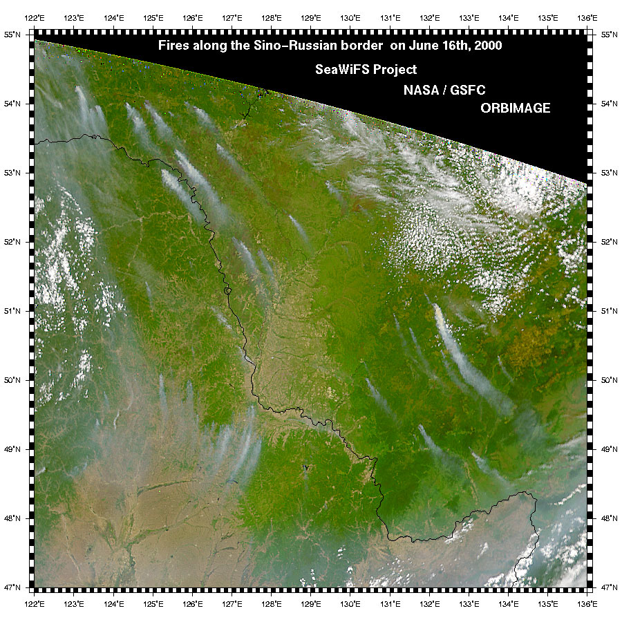 Forest Fires in Russia and Northern China
Smoke plumes from forest fires scattered along the border between the Russian Far East and northern China are clearly visible in this true-color image from the Sea-viewing Wide-Field-of-view Sensor (SeaWiFS) on June 16, 2000. Fires in Siberia occur every summer, and severe outbreaks occur every ten years or so, with the most recent in 1998. The fires are ignited by lightning, and are so remote that it is impossible to fight them effectively.
Provided by the SeaWiFS Project, NASA/Goddard Space Flight Center, and ORBIMAGE 8
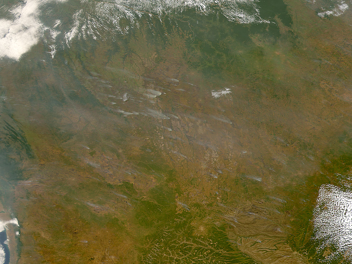 Fires in Central Africa
Hundreds of fires are set every year during the dry season in Central Africa. This true color image from the Sea-viewing Wide Field-of-view Sensor (SeaWiFS) shows dozens of smoke plumes in the Democratic Republic of the Congo on June 29, 2000. Residents burn away scrub and brush annually in the woody savanna to clear land for farming and grazing.
Image Provided by the SeaWiFS Project, NASA/Goddard Space Flight Center, and ORBIMAGE 9
 Large smoke plume of an extended heading fire (driven by the wind) in a South African savanna. This experimental fire was set in the frame of the Southern African Fire-Atmosphere Research Initiative (SAFARI) in 1992 in order to (1) produce a large plume for atmospheric chemical studies, and (2) produce a fire scar for satellite remote sensing instrument validation. 10
 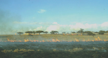 Extended fire in an East African grassland (Kenya) burning under no-plume conditions. This is due to dry weather conditions and the spread of the fire against the wind or flanking into the wind. Smoke from such fires are difficult to be depicted by the NOAA AVHRR. 11
 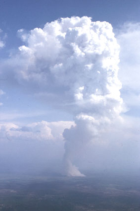 High-intensity fire in a boreal forest of Central Siberia, creating a strong convective activity due to a high-intensity burn. This smoke plume reaches 6000 m above ground (see next slides). 12+13
  Same fire as on previous slide. The experimental fire was set in Kransoyarsk region in 1993 in order to investigate fire behaviour and gaseous and aerosol emissions transported into the higher levels of the atmosphere.
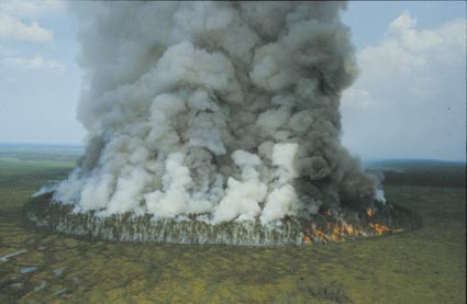
14+15 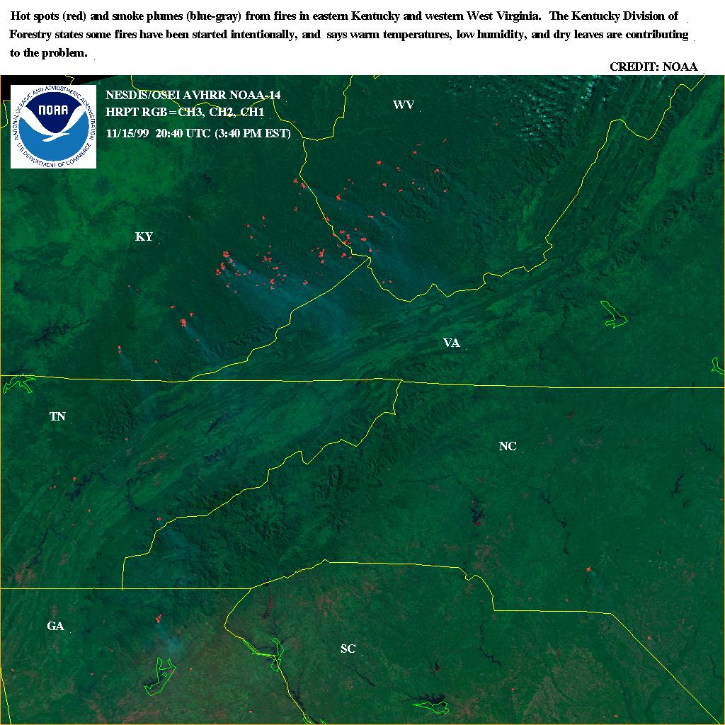

The left image shows heat signatures and smoke plumes from wildfires burning in eastern Kentucky and western West Virginia.
Another view of the mentioned Kentucky fires in the left image is given by following satallite image on the right side from the NASA Goddard Space Flight Center. This is a view eastwards showing the smoke (left side on the image) coming from the fires in Kentucky and West Virginia on Monday, 15 November 1999. The smoke can be seen flowing around the Great Smokey Mountains National Park. (Source: SeaWIFS Project)
Top
Back
