GFMC: Meterological Conditions and Fire in South East Asia
SouthEast Asia
RegularFire and Weather Update
24 June 2004
Latest satellite image
Fires burning across Sumatra on 24 June 2004. Detected by the Moderate Resolution Imaging Spectroradiometer (MODIS) on the TERRA satellite. Active fiores are marked with red dots

TERRA
06/24/2004
03:45 UTC

Some visual impressions


Forest fire fighting underway in forests and peatlands ofRiau and Jambi, Sumatera, Indonesia. Source: GFMC
Latest TOMS images
The Today’s Aerosol Conditions from Earth Probe provides daily updated global TOMS Aerosol Index maps.

(Source: NASA GSFC)

Latest 3 day composite image of TOMS Aerosol Index.
(Source: NASA GSFC)
Latest Media news
Flights disrupted due to haze
June 23, 2004
TheJakartaPost – A number of flights were diverted or delayed on Tuesday as thick haze from forest and farmland fires covered Pekanbaru city in Riau province and parts of the Malaysian peninsula.
Officials said at least eight planes were unable to land at Pekanbaru’s Sultan Syarif Kasim Airport, while another flight could not take off due to poor visibility.
Visibility was only 300 meters at around 6 a.m. and increased to 400 meters two hours later, said Sutrisno, head of airport operator PT Angkasa Pura II.
However, he said, planes started to take off and land at around 9 a.m. after visibility continued to improve.
Sutrisno said the disrupted flights included those of Merpati, Jatayu, Riau Airlines (RAL), Garuda, Mandala and Star Air.
“Even a Star Air flight that left Jakarta for Pekanbaru was forced to land in Medan before continuing to Pekanbaru hours later,” he added.
He said an aircraft of PT Caltex Pacific Indonesia (CPI) had to fly around over Pekanbaru airport, waiting for directions to land.
According to him, the minimal visibility needed for flights to land or take off is 2,000 meters.
The delayed and diverted flights forced hundreds of passengers to wait for hours at the airport.
Earlier on Monday, visibility improved after the thick haze cleared slightly.
Tuesday’s haze also forced motorists to switch on their fog lights and lower their speed, while wearing masks and glasses.
A number of vendors took advantage of the situation by selling masks on several main streets like Jl. Sudirman and Jl. Tuanku Tambusai.
“The smoke is already harmful. It makes my eyes sting and water,” Syafrial, an employee at a private firm, told The Jakarta Post on Jl. Sudirman.
By noon, Pekanbaru city’s skies looked bright again as the haze cleared.
Smoke from forest fires was reported to have drifted across to neighboring Malaysia, shrouding several cities in an unhealthy haze on Tuesday.
“Some people are falling sick due to the haze,” Leong Fong Yi, a college administrator in the northern Malaysian city of Penang, told AP. “I’m really praying hard for heavy rain.”
Visibility at Kuala Lumpur International Airport was down to three kilometers, from the normal 10 kilometers, but airport spokeswoman Wan Hasmi was quoted as saying flights were not yet affected.
There were no clear results yet on Malaysia’s air quality, but preliminary tests showed that Kuala Lumpur, Penang and other cities had poor air quality, said Asmah Ibrahim, director of the environment department’s air division.
Officials blamed the smog on more than 300 “hot spots” detected in Riau and other parts of Sumatra island, separated from peninsular Malaysia by the narrow Malacca Strait.
The fires were set by large forest and plantation concession-holders as well as by small farmers, they said.
Annoyed by the haze, Deputy Riau Governor Wan Abubakar said legal action would immediately be taken on those starting the fires.
“It seems that they take the regulations lightly. As a result, the smoke is everywhere and has disrupted flights. It creates difficulties for all of us,” he said.
Wan said his administration would gather all regency and municipal heads and other relevant authorities to decide on sanctions to be imposed on rogue forest concessionaires blamed for the smog.
“Last year, we brought 10 forestry and plantation companies to court for starting fires to clear land. They are still being dealt with by prosecutors,” he added.
Haze is an annual dry-season phenomena in parts of Indonesia, despite laws banning the use of fire to clear land for cultivation. It spread to much of Southeast Asia in 1997. The ecological disaster sparked a diplomatic row, with economic losses estimated at around US$9.3 billion, and prompted a 2002 agreement between neighboring countries to fight pollution from forest fires.
Haze drifts to other states
June 24, 2004
The Star Online – KUALA LUMPUR: The haze, which has shrouded the Klang Valley in the past week, has drifted to other parts of the peninsula and worsening in the east coast states.
The smog has also started to thicken in the southern states, with Malacca health authorities claming to be treating an increasing number of patients with breathing difficulties.
The KL International Airport saw no disruptions to flight schedules despite reduced visibility, but marine police warned ships plying the Straits of Malacca to navigate with the utmost care over the waterway, especially at night.
Environment officials have blamed forest fires in neighbouring Indonesias Sumatra island for the haze, aggravated by hot and dry weather, which was one of the reasons why the usually cool Cameron High-lands is now suffering from drought.
The Fire and Rescue Department has identified at least four states in the peninsula Kedah, Johor, Selangor and Pahang as well as Sabah and Sarawak as areas for possible outbreaks of major peat fires.
Speaking to reporters in Arau, Perlis, the department’s director-general Datuk Jaafar Sidek Tambi, said these states were affected by hot weather patterns and high humidity.
He said the department would set up temporary operation centres at scenes of major peat fires to ensure they could be doused faster.
The Meteorological Services Departments weather forecast division director Kang Thean Shong said that while the haze was thickening in Kuantan and Mersing and some parts of the east coast, towns like Kota Baru and Kuala Terengganu were not affected yet.
The northern parts of the east coast are sheltered by ahigher mountain range that blocked the wind and slowed the travelling of the pollutants, he said.
Kuantan and Mersing registered low visibility between the range of 2km and 4km yesterday, as winds blowing in the southwest direction carried the air pollutants over from the west coast.
Kang said the visibility level was poor in Malacca, where at one point it dropped to 600m yesterday.
Malacca Health, Human Resources and Consumer Affairs Committee chairman Datuk Seah Kwi Tong said there were an increasing number of patients with respiratory-related sicknesses seeking outpatient treatment.
He said he received this feedback from polyclinics, clinics and hospitals in the state.
Seah, however, said he has not received any official statistics from health departments.
Penang was still shrouded in moderate haze but the condition has improved, with the API recorded at between 51 and 100 in Seberang Prai and on the island.
State DOE director Dr Zulkifli Abdul Rahman said despite the improvement, the temporary ban on open burning was still effective.
I. Monitoring of Smoke-Haze and Active Fires (land-use fires and wildfires)
Regional Smoke-Haze Monitoring
The Meteorological Division of the Singapore National Environment Agency provides a daily updated map showing active fires (land-use fires, wildfires), smoke haze and surface wind directions within the South East Asian region.

-
Latest map of surfacewinds and smoke haze/hot spots observed over cloud-free areas.
(Source: http://app.nea.gov.sg/cms/htdocs/article.asp?pid=1195)
-
Latest regional active fire (hotspot) maps:
http://app.nea.gov.sg/cms/htdocs/article.asp?pid=1674 -
Forecast of winds and surface pressure for the South East Asian Region:
http://app.nea.gov.sg/cms/htdocs/article.asp?pid=1122 - Other Regional NOAA and GOES Satellite Images:
http://app.nea.gov.sg/cms/htdocs/category_sub.asp?cid=59 - Update of Regional Weather and Smoke Haze for the last Month:
http://app.nea.gov.sg/cms/htdocs/article.asp?pid=1196
Fire Activity Monitoring in Borneo (Kalimantan, Sabah, Sarawak)
The Integrated Forest Fire Management Project (IFFM) in Samarinda provides regulary updatedmaps generated by NOAA-AVHRR showing active land-use fires and wildfires inBrunei and the Indonesian and Malaysian provinces on BorneoIsland.

Latest fire overview map for Borneo: 23 June 2004
(Source: IFFM FireMaps)
Fire Activity Monitoring in South Sumatra
The South Sumatra Forest Fire Management Project provides regular fire activity maps based on the products of the MODIS Rapid Response System: http://www.ssffmp.or.id/ssffmp/fwi-2.asp?id=2
Fire Activity Monitoring in Mainland SE Asia
The Asia Pacific Network for Disaster Mitigation using Earth ObservationSatellite (ANDES) provides daily fire maps of mainland and insular South EastAsia. The latest maps can be accessed through the ANDES website. The map below shows the last fire map of mainland SE Asia(Thailand, Myanmar, Lao, Cambodia, Viet Nam).

LastANDESfire location map of mainland South East Asia.
The map is generated on the basis of two satellite sensors (NOOA-AVHRR,DMSP/OLS).
Source: ANDES
II. Fire Weather and Fire Danger Monitoring and Early Warning
Regional Fire Weather
The Regional South East Asia Fire Danger Rating System (SEA FDRS) is a joint effort between the Canadian Forest Service (CFS) and the Malaysian Meteorological Service (MMS), supported by the Canadian International Development Agency (CIDA). Daily updated SEA Fire Danger Rating can be downloaded on the following website of MMS, and background information on the project can be found at the SEA FDRS Project website.

Latest example of a SEA FDRS product:
The Fire Weather Index (FWI) values shown on the map are numerical ratings offire intensity.
Information from the Initial Spread Index (ISI) and Build Up Index (BUI) iscombined to provide a numerical rating of fire intensity.
This index is used to indicate the difficulty of fire control based on the headfire intensity and fire fighting capability.
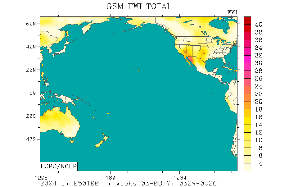
The GFMC displays selected and daily updated global andAsia-Pacific ExperimentalClimate Prediction Center (ECPC) Fire Weather Forecasts.These examples allow a quicklook and provide daily and weekly total forecastsand forecasted monthly totals. For background information refer to the ECPCproducts description page.


tomorrow week monthly
Fire Weather Index (FWI) forecast for thisweek (left) and the predictedFWI total for next month (right)
for the Western Pacific (1-3) and the PacificOcean (4-6) regions.
The weekly total forecast and the monthly forecasted total refer to 00:00 hrsUTC,which is local noon at dateline (180° longitude).
Forecast time is 12:00 hrsnoon UTC (Greenwich)corresponding to local evening time in mainland and insular SE Asia.
(Source: ECPCFire Weather Index Forecast)
Fire Weather in East Kalimantan
Based on data from six weather stations (Indonesian Meterological Service) the following Fire Danger situation has been determined by the Integrated Forest Fire Management Project (IFFM):
Fire Danger Rating for East Kalimantan generally is MODERATE.
– No Hotspot Detected during this week.
– No Land or Forest fire occurences reported by District/municipalities
– The Readiness Level for East Kalimantan is NORMAL.
For more detailed information, see also: Fire situation report of EastKalimantan (17 February 2004), compiled and analyzed by the Provincial Fire Management Center, Samarinda.The complete (detailed) report willbe sent on request. Contact: uptd_pkhl@samarinda.org
Fire Weather in South Sumatra
The South Sumatra Forest Fire Management Project provides regular fire weather updates: http://www.ssffmp.or.id/ssffmp/fwi.asp
Fire Early Warning Bulletin for South East Asia
The World Wide Fund for Nature (WWF) and Project Fire Fight Southeast Asia (PFFSEA) have launched the Fire Bulletin, a weekly analyses and information on fire, haze, and related issues in Indonesia.
III. Further information:
-
The ASEAN Haze Action Online provides the following information:
- Monitoring: Hyperlinks to institutions involved in regional monitoring and prediction of fire and smoke haze
- Haze News: ASEAN Transboundary Haze Update (updated daily)
- Intranet: Information and possible participation in the ASEAN Haze Action Online Intranet Information Services (for associated registered participants)
- Mobilization Plan: Model Fire Suppression Mobilization Plan
- Inventory: Inventory and analysis of forest and land fire suppression capabilities
- Haze Forum: Communication platform on fire and smoke-haze issues in the ASEAN region
- Calendar: Fire and haze-related events can be identified by a search modus
- Media Highlights on Fire, Policies, and Politics
