Current forest fires in the United States
Forest Fires in the United States
24 July 2014
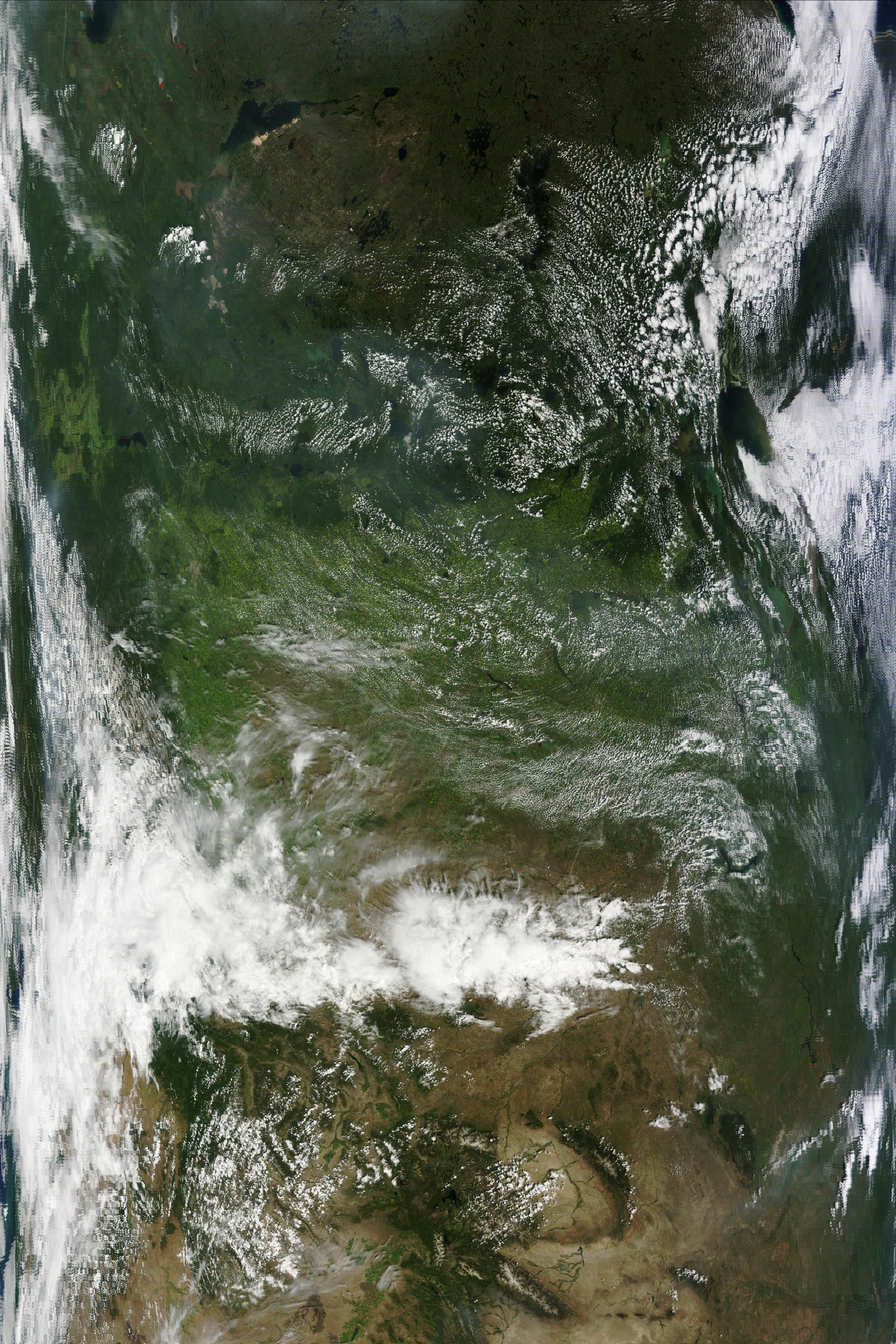
The Moderate Resolution Imaging Spectroradiometer (MODIS) on NASAsTerra satellite acquired this image of the fires affecting Washington State on 22 July 2014 . Currently the most destructive fires such as Carlton Complex Fire is mainly doused. The fire is outlined in red. Some scars can be seen as brown marks. (Image edited and interpreted by GFMC)
Source: NASA Rapid Response.


Images captured by the Moderate Resolution Imaging Spectroradiometers (MODIS) on NASAs Aqua and Terra satellites on 20 July (upper) and 18 July (lower) 2014. Named as the Carlton Complex Fire, is one the main and most drestuctive fires on Washington State, destroying about 200 homes and killing 1 person. Active fires are marked in red.
Source: Nasa Earth Observatory.


Fores Fire Weather Index for 24 and 30 July, 2014. Black dots are representing active fires which burned on 23 July.
Source: Global Fire and Early Warning System (GFEWS)

![]()
The map above shows the amount of underground water stored on the USA territory on 7 July 2014. Areas in blue have more abundant water compared to the red ones that are in serious drought..
Source: NASA Earth Observatory
Recent Media Reports on Fires in the United States: Note: The hyperlinks on the left side of each news are password-protected (User ID and password to enter the GFMC database are available for partners of GFMC. To obtain the ID and password, please send your query tofire@fire.uni-freiburg.de). The links on the right side (in brackets) are leading to the original news source; sometimes these news are expiring rather swiftly – a reason for the establishment of the internal GFMC database):
- Obama signs emergency declaration for Wash. wildfires (published by www.komonews.com 23 July 2014)
- Firefighters advance on biggest wildfire on record in Washington state (published by http://planetark.org 23 July 2014)
- Firefighting death in North Idaho underscores unclear rules (published by www.idahostatesman.com 22 July 2014)
- Tinderbox Explodes in Wildfires Across Northwest (published by www.nytimes.com 22 July 2014)
- Wildfire legislation would fully fund suppression and boost proactive forest management (published by www.wmicentral.com 21 July 2014)
- What Do Wild Animals Do in a Wildfire? (published by http://news.nationalgeographic.com 21 July 2014)
- Washington state wildfire destroys 100 homes, hundreds evacuated (published byhttp://planetark.org 21 July 2014)
- Up to 100 homes lost in Washington wildfire (published by www.spokesman.com 19 July 2014)
- Three firefighters injured in two rollover crashes (published by www.ktvz.com 19 July 2014)
- Wildfires Force Evacuation Of Towns, Hospital In Washington State (published by www.npr.org 18 July 2014)
- Body discovered in area of Northern California wildfire (published by http://planetark.org 18 July 2014)
- More than 850 homes evacuated as huge fire engulfs forest near Leavenworth; U.S. 2 closed (published by http://q13fox.com 17 July 2014)
- Wildfire Destroys Homes, Burns More than 2,000 Acres In South-Central Oregon (published by http://earthfix.opb.org 15 July 2014)
- Australia bushfire survivors in record class action win (published by http://wyofile.com 15 July 2014)
- US wildfire policy inadequate, senators agree (published by www.9news.com 15 July 2014)
- Oregon wildfire forces evacuations, destroys structures (published by http://planetark.org 14 July 2014)
- Opinion: Don’t Log Burned ForestsLet Nature Heal Them (published by http://news.nationalgeographic.com 14 July 2014)
- House: Less money for EPAs climate fight, more money for drought-worsened wildfires (published by www.washingtonpost.com 09 July 2014)
- Wildfires included in immigration funding request (published by www.9news.com 08 July 2014)
- New type of soot particle discovered from wildfire emissions (published by http://phys.org 08 July 2014)
- Military stops giving leftover equipment to rural firefighters (published by www.newsandtribune.com 06 July 2014)
- 20 Years Later, Legacy of a Deadly Colorado Wildfire Endures (published by http://news.nationalgeographic.com 04 July 2014)
- Burn, Baby, Burnif We Say So (published by www.slate.com 04 July 2014)
- Climate-Driven Wildfires Consume Forest Service Budget (published by www.bloomberg.com 03 July 2014)
- Wildfire near California’s wine country threatens homes (published by http://planetark.org 03 July 2014)
- Wildfires Blazing in Northern Canadian Forests Send Plumes of Smoke More than a Thousand Miles South to Colorado (published by http://blogs.discovermagazine.com 02 July 2014)
ore reports see GFMC Media page: https://gfmc.online/media-highlights-on-fire-policies-and-politics.html
Top
Back
