Summit Fire, California
Summit Fire, California
26 May 2008
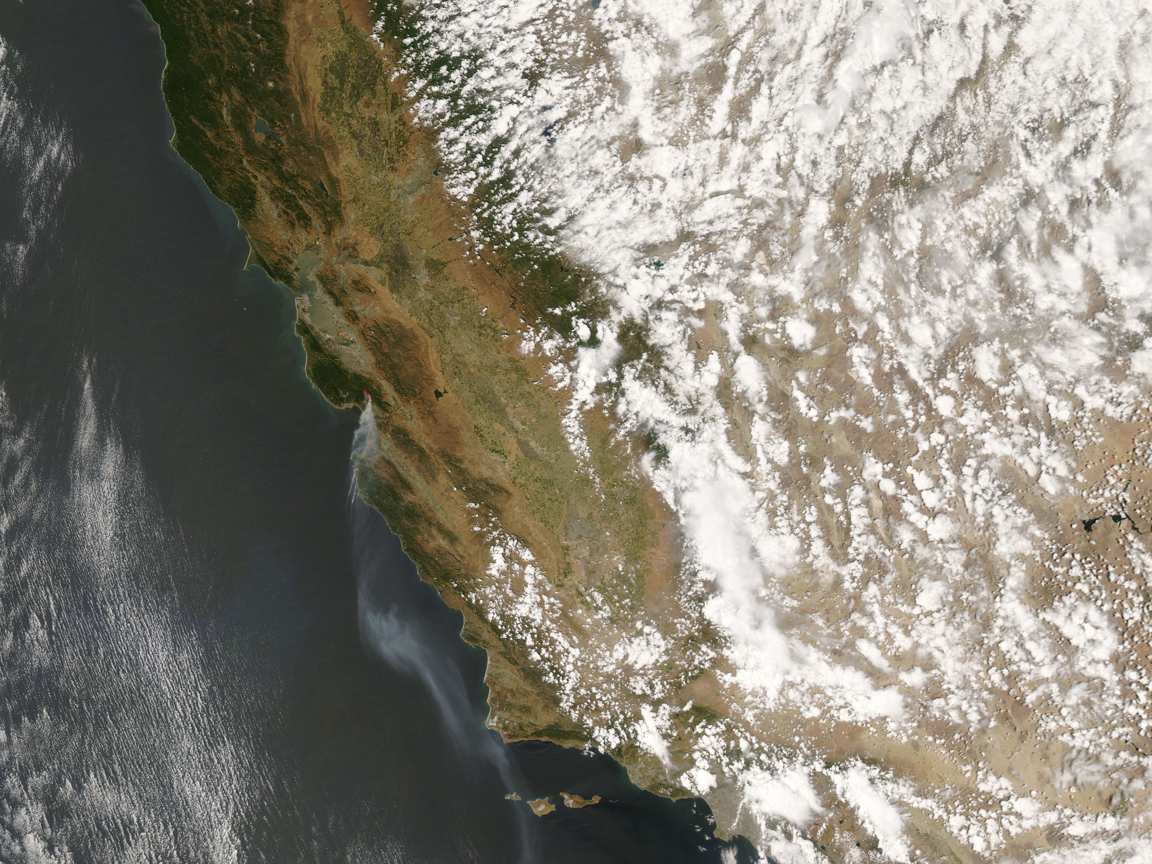
Road closures and evacuations were in effect in the Santa Cruz Mountains south of San Jose, California, on 23 May 2008, because of a wildfire that had burned about 3,000 acres. The Summit Fire was threatening small towns in the region, and was about 15 percent contained according to the 23 May report from the National Interagency Fire Center. This image of the fire (outlined in red) was captured by the Moderate Resolution Imaging Spectroradiometer (MODIS) on NASAs Aqua satellite on 22 May 2008. A strong wind was spreading smoke southward over Monterey.

AQUA
22 May 2008

Click here to view high-resolution version (3.35 MB)
(source: earth observatory)
The high-resolution image provided above is at MODIS maximum spatial resolution (level of detail) of 250 meters per pixel.
