Fires in Southeast Asia
Fires in Southeast Asia
13 February 2008
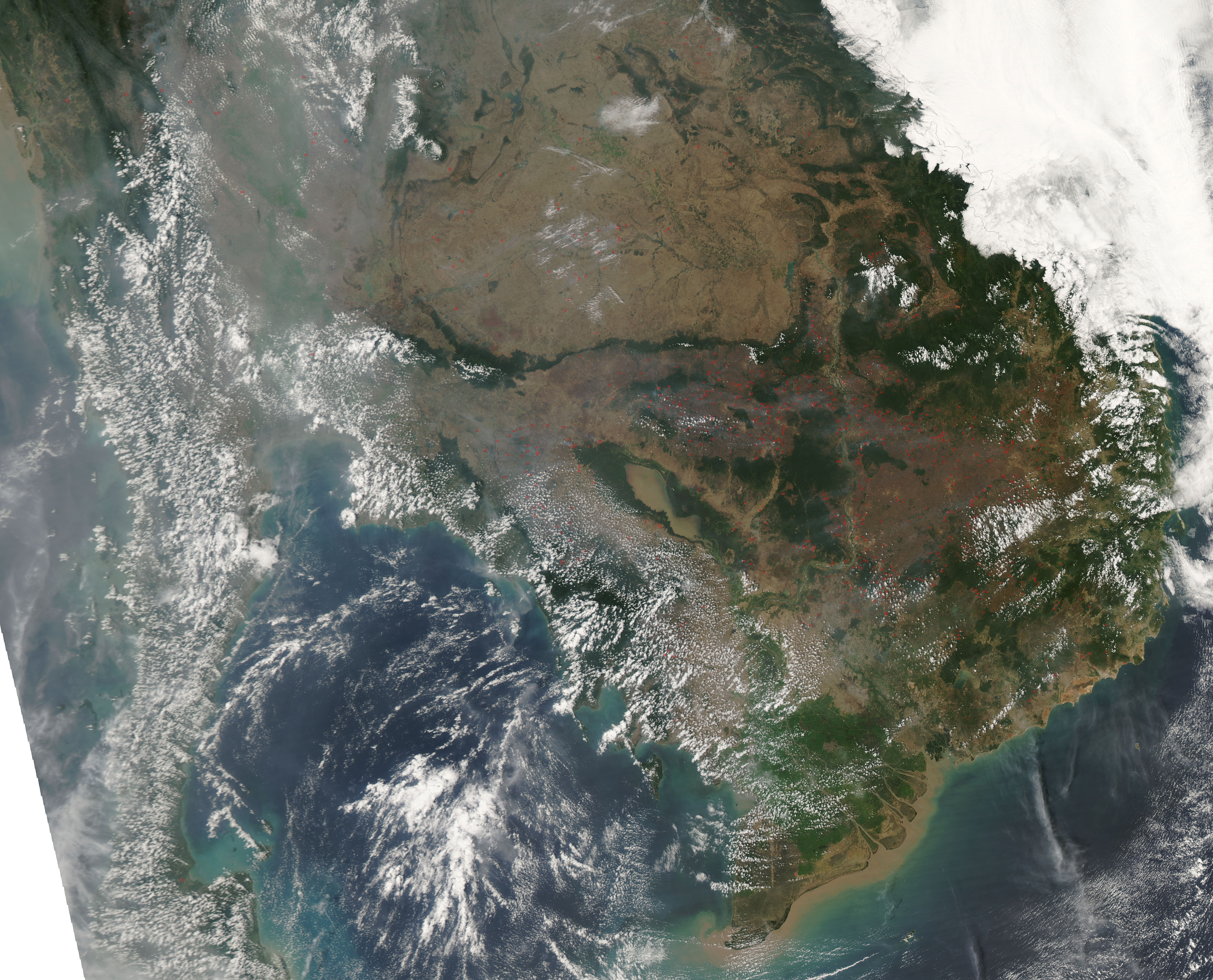
In Cambodia and other countries in Southeast Asia, the dry season is a time for agricultural burning, and the skies often become thick with smoke for week-long stretches. This image from the Moderate Resolution Imaging Spectroradiometer (MODIS) on NASAs Aqua satellite shows widespread fires activity (locations marked in red) across Cambodias agricultural areas on February 9, 2008. Although such widespread burning is not necessarily immediately hazardous, it can have a strong impact on weather, climate, human health, and natural resources.

AQUA
11 February 2008
Click here to view high-resolution version (3.76MB)
(source: earth observatory)
Further information:
-
The ASEAN Haze Action Online provides the following information:
-
Monitoring: Hyperlinks to institutions involved in regional monitoring and prediction of fire and smoke haze
-
Haze News: ASEAN Transboundary Haze Update (updated daily)
-
Intranet: Information and possible participation in the ASEAN Haze Action Online Intranet Information Services (for associated registered participants)
-
Mobilization Plan: Model Fire Suppression Mobilization Plan
-
Inventory: Inventory and analysis of forest and land fire suppression capabilities
-
Haze Forum: Communication platform on fire and smoke-haze issues in the ASEAN region
-
Calendar: Fire and haze-related events can be identified by a search modus
-
