GFMC: Meterological Conditions and Fire in South East Asia
SouthEast Asia
RegularFire and Weather Update
20 August 2005
Current Media Information:
-
Forest fire haze worsens; flights grounded (published by www2.sgvtribune.com, 20 August 2005)
-
Haze a health hazard (published by www.thejakartapost.com, 20 August 2005)
-
Plantation: We are not behind fires (published by thestar.com.my, 20 August 2005)
-
South Korea, Japan Offer Help For Asean To Tackle Haze (published by www.bernama.com.my, 19 August 2005)
-
Haze: Moderate API Readings In 19 Areas (published by www.bernama.com.my, 19 August 2005)
-
Sumatrans go bare-faced despite haze (published by thestar.com.my/news, 19 August 2005)
-
Haze symptomatic of countrys malaises (published by www.malaysiakini.com, 19 August 2005)
UNOCHA / GFMC: Indonesia: Fires OCHA Situation Report No. 1 (published by UNOCHA, 16 August 2005)
UNOCHA / GFMC: Indonesia: Fires OCHA Situation Report No. 2 (published by UNOCHA, 19 August 2005)
See also earlier GFMC Updates:
19 August 2005: https://gfmc.online/gfmcnew/2005/08/0819/20050819_sea.html
18 August 2005: https://gfmc.online/gfmcnew/2005/08/0817/20050818_sea.html
17 August 2005: https://gfmc.online/gfmcnew/2005/08/0817/20050817_sea.html
16 August 2005: https://gfmc.online/gfmcnew/2005/08/0815/20050816_sea.html
15 August 2005: https://gfmc.online/gfmcnew/2005/08/0815/20050815_sea.html
28 February 2005: https://gfmc.online/gfmcnew/2005/02/0228/20050228_sea.html
6 February 2005: https://gfmc.online/gfmcnew/2005/02/0206/20050206_sea.html
21 January 2005: https://gfmc.online/gfmcnew/2005/01/0121/20050121_sea.html
and others displayed on the current and archive website of the GFMC.
The following information is taken from the following websites of the Indonesian Ministry for Forestry and reflects the situation back in the 1990s when land-use fires burned in the same regions of Sumatra, especially in Riau Province in a similar way as they continue in 2005:
- The July 2001 Fires in Central Sumatra: http://www.dephut.go.id/INFORMASI/PHPA/FFPCP/articles/FFPCP%20-%20The%20July%202001%20Fires%20in%20Central%20Sumatra.htm
- This and other articles published by the Forest Fire Prevention and Control Project (FFPCP) in the late 1990s to 2001, as well as archived and evaluated media reports are available on: http://www.dephut.go.id/INFORMASI/PHPA/FFPCP/articles.htm
Air Quality Emergency in Malaysia
The noxious haze that prompted Malaysian officials to declare an air quality emergency in many locations has eased after a shift in the winds and rain cleared the air. The haze is being generated by intense forest fires burning in Sumatra. Smoke began to build up over Malaysia on 2 August 2005, closing schools and businesses in the worst haze crisis since 1997-1998, the Associated Press reports. The haze lifted starting on 13 August, though the fires are still burning.

TERRA
MOPITT
1-15 August 2005

In addition to smoke, the fires have released large amounts of carbon monoxide into the atmosphere, which have been detected by the Measurements of Pollution in the Troposphere (MOPITT) radiometer on NASAs Terra satellite. Carbon monoxide is a good tracer of pollution since it is produced as a by-product of the combustion associated with wildfires and agricultural fires.
This image shows carbon monoxide concentrations between 1 and 15 August 2005. The highest concentrations, shown in red and yellow, hang over Malaysia near its capital, Kuala Lumpur. In these regions, for every billion molecules in a column of the atmosphere, 240 are carbon monoxide molecules. By contrast, regions unaffected by haze have less than 120 molecules per billion. High concentrations of carbon monoxide are a threat to human health.
(source: earth observatory)
I. Monitoring of Smoke-Haze and Active Fires (land-use fires and wildfires)
Regional Smoke-Haze Monitoring
The Meteorological Division of the Singapore National Environment Agency provides a daily updated map showing active fires (land-use fires, wildfires), smoke haze and surface wind directions within the South East Asian region.

Latest map of surface winds and smoke haze/hot spots observed over cloud-free areas.
(Source: http://app.nea.gov.sg/cms/htdocs/article.asp?pid=1195)
-
Latest regional active fire (hotspot) maps:
http://app.nea.gov.sg/cms/htdocs/article.asp?pid=1674 -
Forecast of winds and surface pressure for the South East Asian Region:
http://app.nea.gov.sg/cms/htdocs/article.asp?pid=1122 - Other Regional NOAA and GOES Satellite Images:
http://app.nea.gov.sg/cms/htdocs/category_sub.asp?cid=59 - Update of Regional Weather and Smoke Haze for the last Month:
http://app.nea.gov.sg/cms/htdocs/article.asp?pid=1196
Fire Activity Monitoring in Borneo (Kalimantan, Sabah, Sarawak)
The Integrated Forest Fire Management Project (IFFM) in Samarinda provides regulary updated maps generated by NOAA-AVHRR showing active land-use fires and wildfires in Brunei and the Indonesian and Malaysian provinces on Borneo Island.

Latest fire overview map for Borneo: 15 December 2004
(Source: IFFM Fire Maps)
Fire Activity Monitoring in South Sumatra
The South Sumatra Forest Fire Management Project provides regular fire activity maps based on the products of the MODIS Rapid Response System: http://www.ssffmp.or.id/ssffmp/fwi-2.asp?id=2
II. Fire Weather and Fire Danger Monitoring and Early Warning
Regional Fire Weather
The Regional South East Asia Fire Danger Rating System (SEA FDRS) is a joint effort between the Canadian Forest Service (CFS) and the Malaysian Meteorological Service (MMS), supported by the Canadian International Development Agency (CIDA). Daily updated SEA Fire Danger Rating can be downloaded on the following website of MMS, and background information on the project can be found at the SEA FDRS Project website.

Latest example of a SEA FDRS product:
The Fire Weather Index (FWI) values shown on the map are numerical ratings of fire intensity.
Information from the Initial Spread Index (ISI) and Build Up Index (BUI) is combined to provide a numerical rating of fire intensity.
This index is used to indicate the difficulty of fire control based on the head fire intensity and fire fighting capability.
Information on the Indonesian Fire Danger Rating System (Indonesian FDRS) is provided by the Indonesian Bureau of Meteorology and Geophysics (BMG) in Jakarta. The site provides information for fire managers working to prevent and control vegetation fires and smoke in Indonesia. This link points to the English version; a Bahasa Indonesian version can be found there as well: http://www.bmg.go.id:8080/fdrs/index_e.html.
The GFMC displays selected and daily updated global and Asia-Pacific Experimental Climate Prediction Center (ECPC) Fire Weather Forecasts. These examples allow a quicklook and provide daily and weekly total forecasts and forecasted monthly totals. For background information refer to the ECPC products description page.


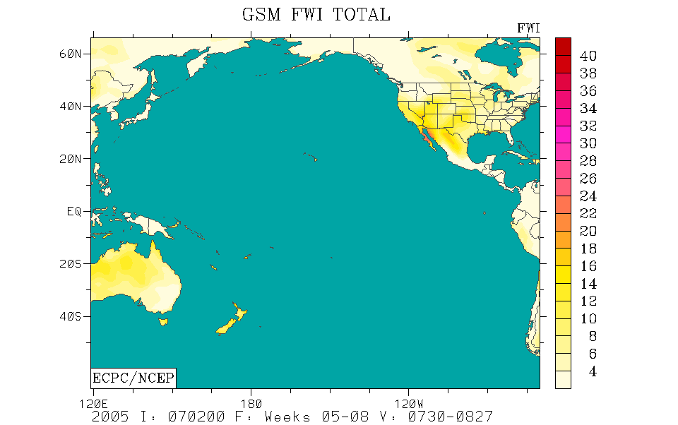
tomorrow – week – monthly
Fire Weather Index (FWI) forecast for this week (left) and the predicted FWI total for next month (right)
for the Western Pacific (1-3) and the Pacific Ocean (4-6) regions.
The weekly total forecast and the monthly forecasted total refer to 00:00 hrs UTC, which is local noon at dateline (180° longitude).
Forecast time is 12:00 hrs noon UTC (Greenwich) corresponding to local evening time in mainland and insular SE Asia.
(Source: ECPC Fire Weather Index Forecast)
III. Further information:
-
The ASEAN Haze Action Online provides the following information:
- Monitoring: Hyperlinks to institutions involved in regional monitoring and prediction of fire and smoke haze
- Haze News: ASEAN Transboundary Haze Update (updated daily)
- Intranet: Information and possible participation in the ASEAN Haze Action Online Intranet Information Services (for associated registered participants)
- Mobilization Plan: Model Fire Suppression Mobilization Plan
- Inventory: Inventory and analysis of forest and land fire suppression capabilities
- Haze Forum: Communication platform on fire and smoke-haze issues in the ASEAN region
- Calendar: Fire and haze-related events can be identified by a search modus
- Media Highlights on Fire, Policies, and Politics
