Fires in Alaska
Fires inAlaska
15 July 2005
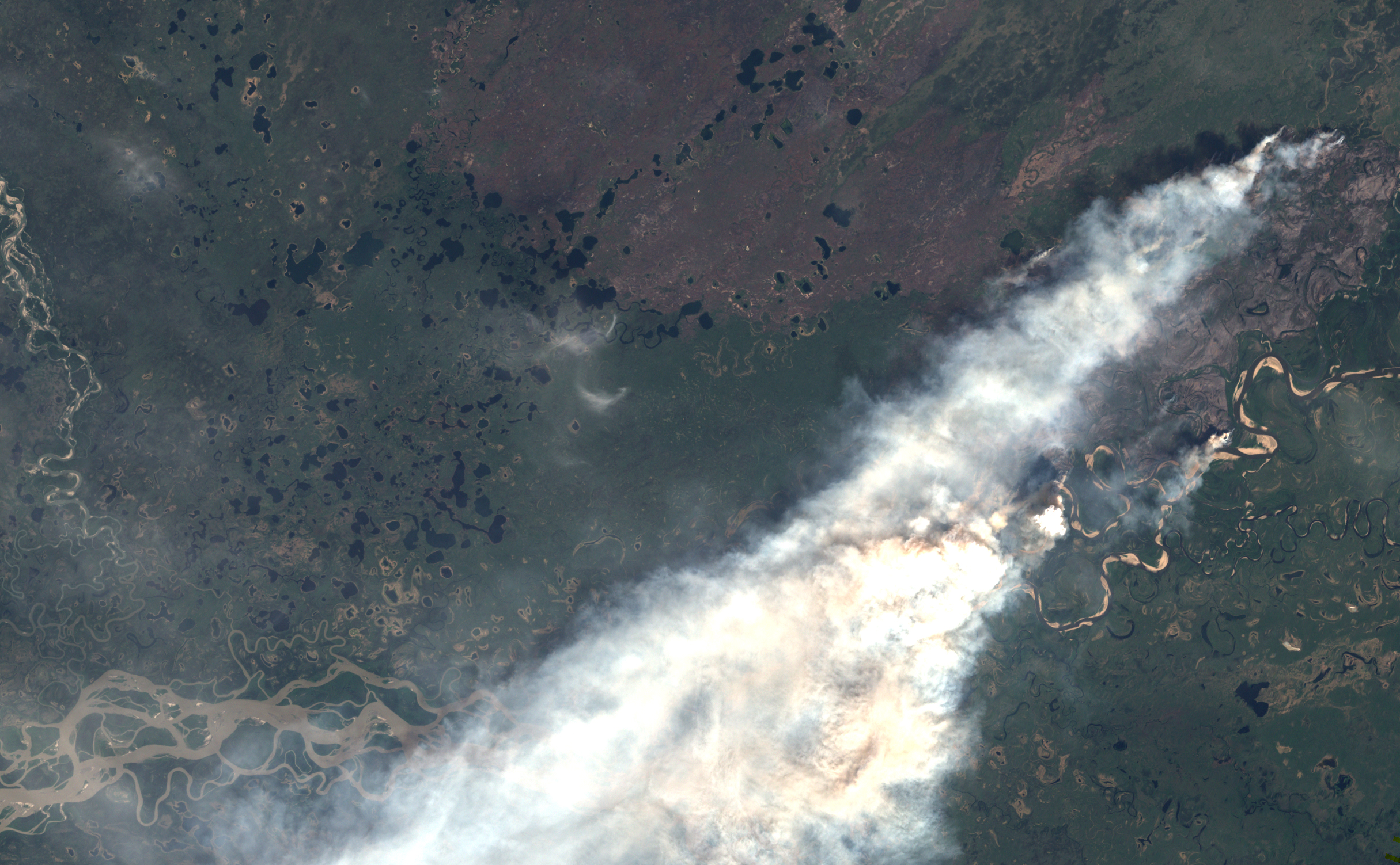
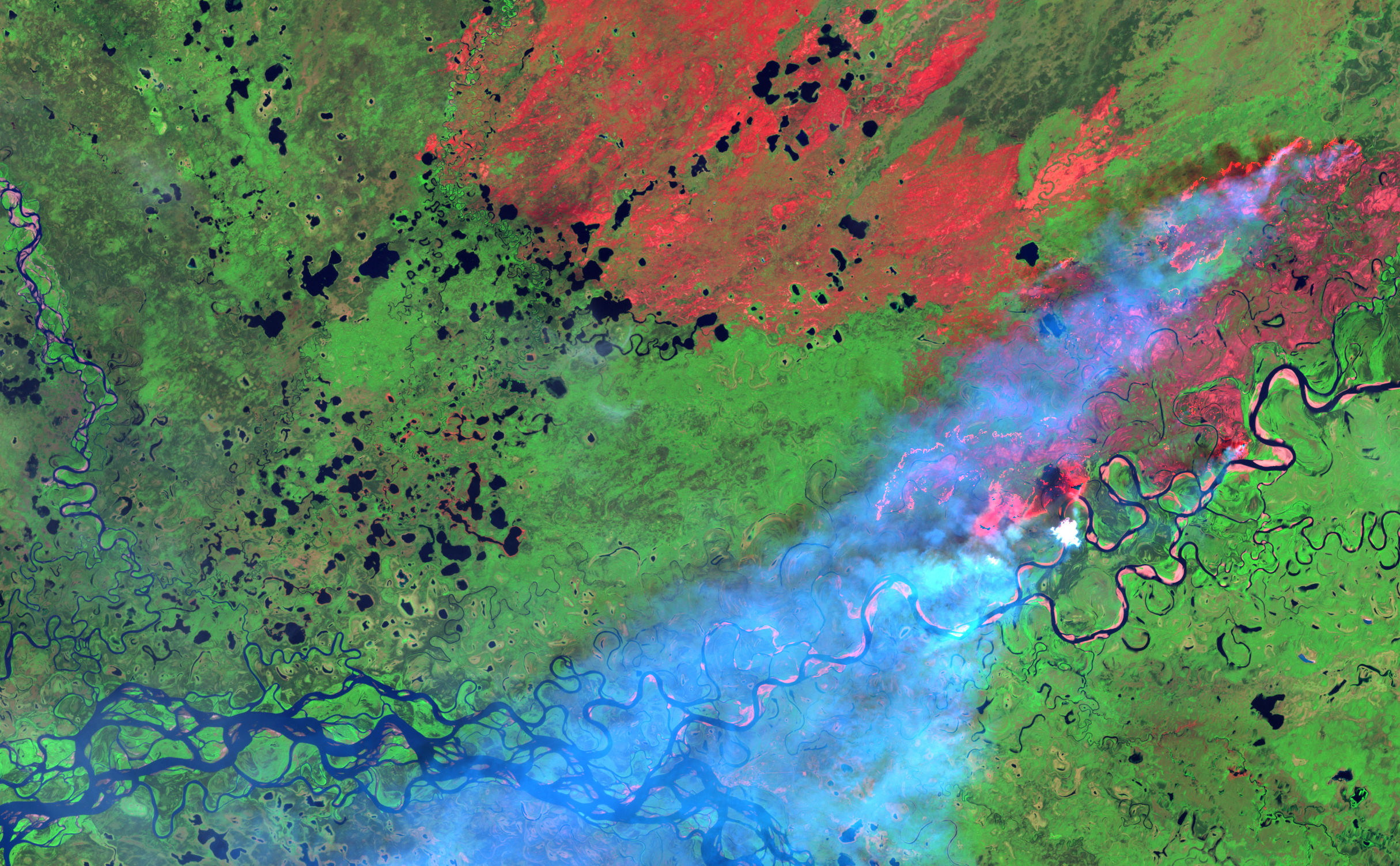
More than a million acres had been affected by fires in Alaska as of July 11, 2005. Almost 10 percent of that total is attributable to the Sheenjek River Fire north of Fort Yukon, Alaska, which was estimated to be about 105,787 acres on July 11. This pair of Landsat satellite images shows the area in natural color (top) and infrared-enhanced false color on June 20, 2005. The fire is affecting an area that stretches from the confluence of the Sheenjek River (image right) with the Yukon (bottom left) northeastward for more than 50 kilometers. Unburned vegetation is bright green in the false-color image, water is blue, and recently burned (and possibly still burning) areas are bright pink. The area burned during the 2004 Winter Trail Fire is in the top center of the images; the burn scar of that fire is slightly more orange than the current Sheenjek Fire scar.

Landsat 7- ETM+
20 June 2005

High resolution images:
True colour (2.9 Mb)
False colour (4.5 Mb)
(source: EarthObservatory)
Images based on data by NASA Landsat Project Science Office and National Center for Earth Resources Observation & Science(NCEROS)
For background information on the Fire Situation in Alaska see:
- Alaska Fire Service website
- Geographic Information Network of Alaska
- Alaska Fire Service Report Page
