Fires on Cape York Peninsula
Fires on Cape York Peninsula
15 December 2005
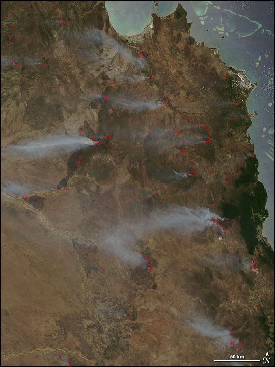
Dozens of fires were scattered across central and southern Cape York Peninsula in northeastern Australia on14 December 2005. When the Moderate Resolution Imaging Spectroradiometer (MODIS) on NASAs Aqua satellite passed over the region, the sensor detected actively burning areas (marked in red) across a broadregion.

AQUA
14 December 2005
9:35 hrs UTC
click on image for a 250 m resolution
Winds were pushing smoke plumes toward the west at the time of the image. Natural resource managers in northern Australia use fire to help maintain native grassland and control exoticspecies. Many of the fires in this image may be land-management fires set by public or private landmanagers.
(source: EarthObservatory)


