el nino
ElNiño and La Niña
La Niña is essentially the opposite of El Niño. During La Niña, the trade windseasterly winds that blow through the tropics and subtropicsare stronger than normal.Likewise, the cold water that normally exists along the coast of South America extends to the central equatorial Pacific. La Niña reappears every three to fiveyears. At the beginning of 2006, scientists were still unsure whether this cold pool would evolve into along-lasting, strong La Niña condition. If so, it could be expected to reorganize global weatherpatterns.
As water warms, it expands. As it cools, it contracts. Because of this correlation between temperature and water-columnheight, the height of the sea surface tells scientists about the oceanstemperature. La Niña is a cooling of the equatorial waters in the Pacific, and this phenomenon affects weather over much of thatocean. As 2005 drew to a close, sea-surface height changes in the tropical Pacific exhibited characteristics of a developing La Niña.
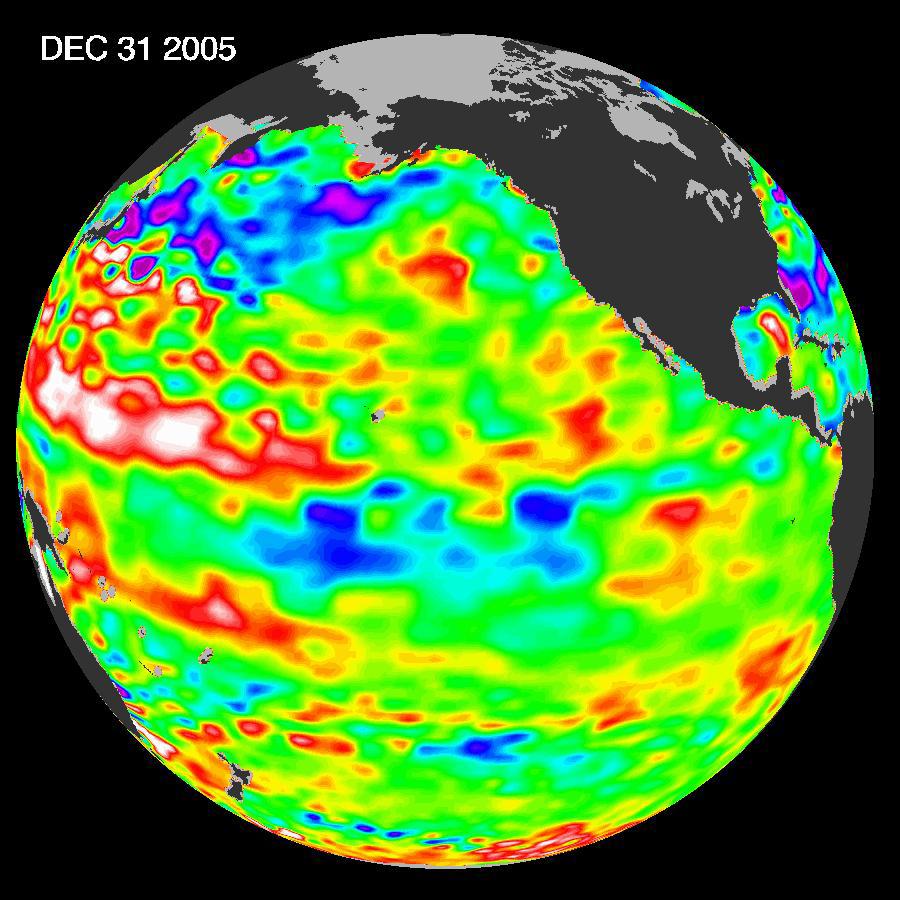
The image shows sea surface height relative to normal ocean conditions. Produced from sea-surface height measurements taken by the U.S.-French Jason satellite, this image shows a continuation of the gradual cooling of the central equatorial Pacific that appeared in the last few months of 2005. The white areas indicate sea surface height between 14 and 32 centimeters (6 to 13 inches) above normal. The red areas indicate a height about 10 centimeters (4 inches) above normal. The green areas indicate normal conditions. The purple areas are 14 to 18 centimeters (6 to 7 inches) below normal. The blue areas are 5 to 13 centimeters (2 to 5 inches) below normal.
[
| Back ]
