Wildland Fire Update
Attention: All links to the NIFC and BLM websites are not operational because of litigation against the Department of the Interior (DOI)
regarding access to Indian trust data or assets. On 5 December 2001, a court
order required DOI and its agencies to disconnect from the internet all
information systems until it can be demonstrated that systems housing or
providing access to individual Indian trust data or assets meet appropriate
security standards.
The GFMC will monitor the developments and remove this notification when
internet access to DOI websites and electronic communication will be resumed.
The National Interagency Fire Center (NIFC) based in Boise (Idaho) provides key information on current wildland fire situations, related information and background materials. The following information is updated daily and can be accessed directly:
- State-by-State daily and year-to-date summary of fire activities
http://www.nifc.gov/fireinfo/nfn.html
- Year-to-date State-by-State total number of wildland fires and area
burned (table)
http://www.nifc.gov/fireinfo/nfnmap.html
- Daily locations of large fires (map)
http://www.nifc.gov/fireinfo/firemap.html
The National Interagency Coordination Center (NICC) provides daily situation reports. These reports include:
- Incident Management Situation Reports (fires and area burned reported to NICC). The files include current, previous and archived reports
- Prescribed Fire and Wildland Fire Use (year-to-date fires and area burned reported to
NICC, posted weekly on Monday mornings)
http://www.nifc.gov/news/RXWFUYTD.htm
Fire Weather & Fire Danger Information
The Wildland Fire Assessment System (WFAS) is a contribution of "The Fire Behavior Research Work Unit", Missoula (Montana USA). The broad area component of the Wildland Fire Assessment System (WFAS) generates maps of selected fire weather and fire danger components.
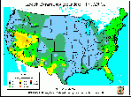
Fire Danger (Potential) is a normalized adjective rating class across different fuel models and station locations. It is based on information provided by local station managers about the primary fuel model, fire danger index selected to reflect staffing level, and climatological class breakpoints. Low danger (Class 1) is green and extreme potential (Class 5) is red.
Fire danger maps for the United States for 12
February 2002 (observation time) and 13 February 2002 (forecast)
(Source: WAFS)
Dead fuel moisture responds solely to ambient environmental conditions and is critical in determining fire potential. Dead fuel moistures are classed by timelag.
Fuel moisture maps for conterminous US, 12 February 2002
(Source: WAFS)
The Keetch-Byram Drought Index (KBDI) is a soil/duff drought index. Factors in the index are maximum daily temperature, daily precipitation, antecedent precipitation, and annual precipitation. The index ranges from 0 (no drought) to 800 (extreme drought) (details).
Keetch-Byram Drought Index Maps for conterminous US, 12
February 2002
(Source: WAFS)
Near-real time satellite images
Operational
Significant Event Imagery (OSEI)
The following significant events were identified by Satellite Analysis
Branch meteorologists and reviewed by the OSEI support team of the
National Oceanic and Atmospheric Administration (NOAA):
NESDIS/OSEI NOAA-12 POES AVHRR LAC satellite images,
Heat signatures (red) and smoke (light blue haze) are visible from fires burning in Southern California and Mexico. A 3,000 acre wildfire moved onto Camp Pendleton on Monday after burning dozens of homes and injuring 11 people in a wealthy enclave near Fallbrook, CA. This information is from the San Diego Union-Tribune (13 February 2002).
(Source: OSEI/NOAA)


