Forest Fires in the United States
17 November 1999
Forest fires in Georgia
Firefighting teams worked against strong winds and dry conditions yesterday to control
wildfires that have burned more than 850 hectares of forest in the Appalachian foothills
of north Georgia. A detailed report about the Georgia fire is published by Planet Ark on 17 November 1999 with the
title Forest
fires destroy Georgia wilderness.
Several active fire signals are recorded by OSEI with the NOAA-14 POES AVHRR HRPT satellite on 15 and 16 November 1999 in the southeastern United States.
 |
 |
 |
Fig. 1-3. The left image shows heat
signatures and smoke plumes from wildfires burning in eastern Kentucky and western West
Virginia. Further areas of fire in Mississippi, Alabama, Tennessee, western North
Carolina, South Carolina and Georgia are displayed in the other two images.
(Source: NOAA http://www.osei.noaa.gov/)
Another view of the same above mentioned Kentucky fires in the left image is given by following satallite image from the NASA Goddard Space Flight Center.
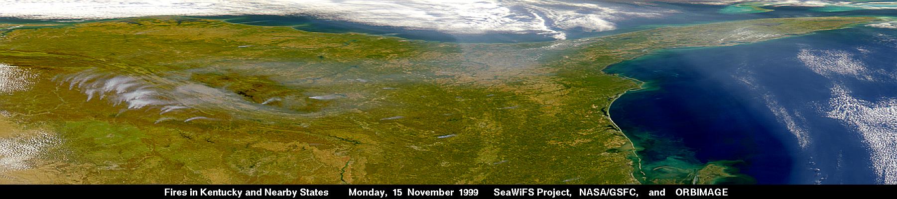
Fig. 4. This is a view eastwards showing the smoke
(left side on the image) coming from the fires in Kentucky and West Virginia on Monday, 15
November 1999. The smoke can be seen flowing around the Great Smokey Mountains
National Park.
(Source: SeaWIFS Project)
The Wildland Fire Assessment System, provided by "The Fire Behavior Research Work Unit", Missoula (Montana USA), produces following fire danger map.

Fig. 5. Fire Danger Forecast Map, 17 November 1999
(Source: Fire Behavior
Research Work Unit, Missoula)
The Wildland Fire Update from the National Interagency Fire Center (NIFC) will be updated every Friday unless significant activity occurs.
According the INCIDENT MANAGEMENT SITUATION REPORT the situation for 16 November 1999 can be quoted as follows:
"...
CURRENT SITUATION
There was moderate to high initial attack activity in the Eastern and Southern Areas. New
large fire activity occurred in the Southern and Southwest Areas. The National Interagency
Coordination Center mobilized a helicopter, an airtanker, large transport aircraft,
leadplane, tactical aircraft, telecommunications equipment, crews and miscellaneous
overhead. Very high to extreme fire indices were reported in
California, Utah, Colorado, Kansas, North Dakota, Nebraska, South Dakota, Wyoming,
Indiana, Illinois, Missouri, Arkansas and Oklahoma.
OUTLOOK
North Carolina will be mostly sunny with high temperatures in the 50's and 60's. Winds
will be north to northwest at 15 to 25 miles per hour.
Georgia will be sunny with high temperatures mostly in the 60's. Winds will be north to
northwest at 15 to 30 miles per hour.
Kentucky will be sunny with high temperatures ranging from 45 to 60 degrees. Winds will be
north to northwest at 10 to 20 miles per hour.
... ."
Following basic fire data describe the fire situation in the United States:
| Number of FIRES in the last 24 hours | HECTARES burning in the last 24 hours | FIRES YEAR-TO-DATE |
HECTARES YEAR-TO-DATE |
| 540 | 6,453 | 87,159 | 2,229,086 |
For detailed information regarding specified regions, please refer to the whole report.