Operational
Significant Event Imagery (OSEI)
The following significant events were identified by Satellite Analysis Branch
meteorologists and reviewed by the OSEI support team of the National Oceanic
and Atmospheric Administration (NOAA):
NESDIS/OSEI NOAA-14 POES AVHRR LAC satellite images,
Heat signatures (red) and smoke (light blue haze) are visible from fires burning in eastern Russia..
(Source: OSEI/NOAA)

Avialesookhrana
from the National Forest Fire Centre of Russia provides up-to-date NOAA images
for the whole of the Russian Federation and neighbour territories. The Space Monitoring Information Support
Laboratory provides extensive links to sites with satellite imagery for
the Russian Federation, meteorological information as well as fire related
images are accessible.
The NOAA AVHRR satellite image composite of 28 June 2002 shows fire
activities in the Russian Federation.

NOAA 12 & 14 AVHRR composite of 28 June 2002.
The red squares indicate regions of active fires. For details the GFMC readers
are encouraged to
use the hyperlinks provided by Avialesookhrana, the Aerial Forest Fire
Protection Service of the
Federal Forest service of Russia. (Source: Avialesookhrana cloudiness maps)
According
to the situation report of the Ministry of Natural Resources of 25 June 2002 a
total of 117 fires affected 6,445 ha forested and 1,562 ha non-forested areas.
Plus the 4 fires were put out the same day when it were started. Since the
beginning of the 2002 fire season a total of 16,410 fires affected 624,105 ha
forested and 298,471 ha non-forested land.
The most fire activity retain in Iakuteia.
There was 27 large fires, the biggest was 14,500 ha forested and 5,000 ha
non-forested.
Through all of Russia on fire fighting have been involved 2244 people, 41
aircraft, 245 bulldozers, tractors and engines.
Source:
Aerial Forest Fire Protection Service of
Russia (Avialesookhrana)
Eurasian Experimental Fire Weather
Information System
The system has been developed by forest fire researchers from Canada, Russia and Germany
is displayed on this website starting 18 July 2001. Complete information and a set of
daily fire weather and fire behaviour potential maps covering Eurasia (the Baltic Region,
Eastern Europe, countries of the Commonwealth of Independent States, Mongolia) can be
accessed at:
http://www.uni-freiburg.de/fireglobe/fwf/eurasia.htm
|
|

Figure 1. Example of the Eurasian
Experimental Fire Weather Information System:
The Experimental Fire Weather Index (FWI) for Russia and neighbouring
countries, 27 June 2002.
Daily Fire Occurrence and Fire Danger Maps of the Fire Laboratory
of the Sukachev Institute of Forest, Krasnoyarsk
Selected fire occurrence maps, satellite images and a forest fire danger map are prepared
daily by the Russian GFMC correspondent Dr. Anatoly Sukhinin, Fire Laboratory of the
Sukachev Institute of Forest, Krasnoyarsk, in collaboration with the
Emergency Situation Monitoring and Forecasting Agency, Krasnoyarsk branch. The maps
are produced on the base of satellite data (classification by the NOAA AVHRR). They show
the fire locations (by latitude and longitude) and the area affected by fire (red
signature, size in ha). The red arrow at each fire location points to the nearest
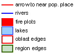
populated place. The terms Oblast or Krai used in the maps are
designations of administrative regions. A map showing the boundaries of
administrative regions and a legend is included below.
|
|
Map legend |
Administrative boundaries |

27 June 2002:
Overview map showing large fire locations covering the 10-days period 17 June to 27 June 2002:
|
|
| Overview |

 |
 |
 |
| Evenkiski Autonomous Region | Khanty Mansisk | Khanty Mansisk |
 |
 |
 |
| Khabarovsk Krai | Khabarovsk Krai | Jakutia |
 |
 |
 |
| Jakutia | Jakutia | Jakutia |
For more details on fire in the Russian Federation, Mongolia and China: See IFFN Country Notes. Scientific details on fire in the Russian Federation are provided by the Fire Research Campaign Asia-North (FIRESCAN) report.
Bibliography on fire in ecosystems of boreal Eurasia:
One of the results of the first international fire science conference in the
Russian Federation (1993) was the publication of a monograph on fire in boreal Eurasia,
including some selected contributions on boreal North America. The literature cited in the
monograph contains numerous publications which in many cases are not easily accessible. To
facilitate literature search the bibliographical sources are provided by topic (chapter).
Goldammer, J.G. and V.V.Furyaev. 1996. Fire
in Ecosystems of Boreal Eurasia. Kluwer Academic Publishers, Dordrecht, 390 p.