2 August 2000
The Canadian Interagency Forest Fire Centre (CIFFC) distributes timely information about forest fires in Canada. The current fire situation for 1 August 2000 can be summarized as follows:
| over the last 24 hours: | 118 fires for 5,005 ha |
| season summary: | 3,689 fires for 257,697 hectares |
According to the National Forest Fire Situation Report of 26 July 2000 (updated every Friday), that a large fire in Saskatchewan near Uranium City (8 km from airport) is out of control at 24 700 ha. Winds are blowing away from the airport, which is not threatened at this time. A fire at Moab Lake in Jasper Park has reached 1050 ha and is expected to be under control soon. Area burned has risen to 15% of normal, due to several large fires in the Northwest Territories. Warmer and drier weather over much of the country will bring increased risk in all regions, particularly in central and northwestern Canada.
Number and area of forest fires in Canada, as of 26 July 2000
| current | uncontrolled | controlled | active modified | |
| 77 | 184 | 90 | ||
| 2000 (to date) |
10-year average |
in % of normal |
Prescribed burning |
|
| Number | 3,233 | 5,326 | 61% | 40 |
| Area (ha) | 227,621 | 1,530,975 | 15% | 7,863 |
The Fire Monitoring, Mapping, and Modelling (FireM3) is a collaboration of the Canadian Forest Service and the Canada Centre for Remote Sensing. Through the Map Link at the FireM3 web site you can access daily hotspot images. An Internet Map Server, which is like a simple GIS running on the host computer, allows you to zoom in on any fire or other area of interest and view the image and map data at full (1 km) resolution. You can also click on any fire and get information about that fire.
 |
 |
 |
Satellite image, daily fire overview map and
season-to-date hotspot map for 31 July 2000
(Source: FireM3)

A satellite image showing hotspots from 20 forest fires in Quebec and
Newfoundland on 31 July 2000. Smoke plumes
were detected using a CCRS algorithm and are enhanced to appear yellow.
(Source: FireM3)
The Canadian Forest Fire Weather Index (FWI) System is a part of the Canadian Wildland Fire Information System and consists of six components that account for the effects of fuel moisture and wind on fire behavior. The first three components are fuel moisture codes and are numerical ratings of the moisture content of litter and other fine fuels, the average moisture contentof loosely compacted organic layers of moderate depth, and the average moisture content of deep, compact organic layers. The remaining three components are fire behavior indexes which represent the rate of fire spread, the fuel available for combustion, and the frontal fire intensity; their values rise as the fire danger increases. For futher information please see the Summary Information.
The latest available images are shown below (30 July 2000):
 Fine Fuel Moisture Code |
 Duff Moisture Code |
 Drought Code |
 Initial Spread Index |
 Buildup Index |
 Fire Weather Index |
 Fire Danger Rating |
The Canadian Forest Fire Behavior Prediction (FBP) System is an other part of the Canadian Wildland Fire Information System and provides quantitative estimates of head fire spread rate, fuel consumption, fire intensity, and fire description. With the aid of an elliptical fire growth model, it gives estimates of fire area, perimeter, perimeter growth rate, and flank and back fire behavior. For futher information please see the Summary Information.
The latest available images are shown below (30 July 2000):
 Foliar Moisture Content |
 Surface Fuel Consumption |
 Rate of Spread |
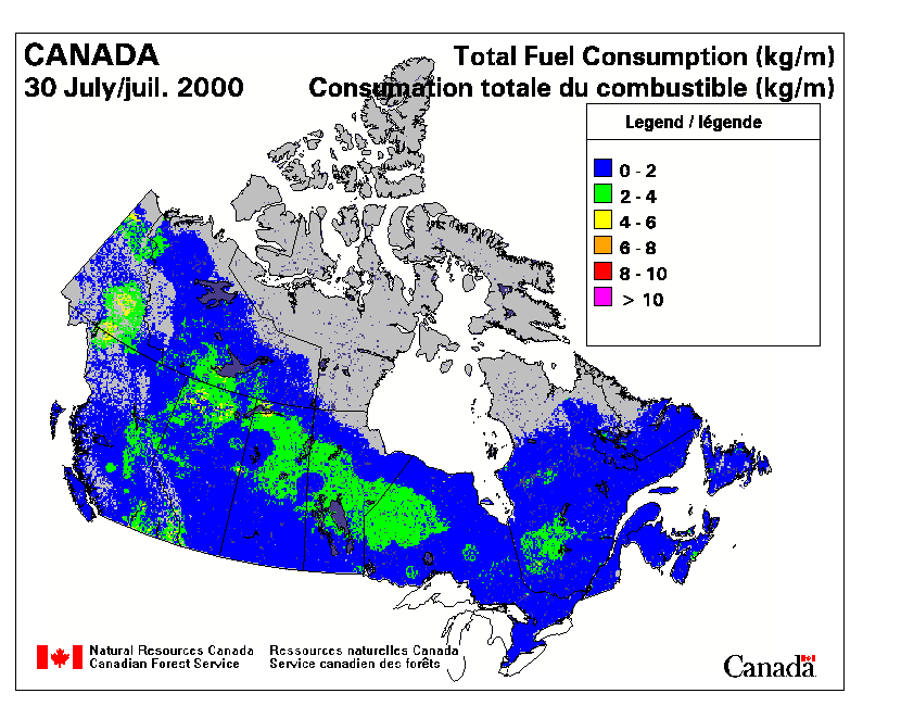 Total Fuel Consumption |
 Head Fire Intensity |
 Fire Type |
The Saskatchewan Daily Forest Fire Situation Report (1 August 2000) is listing all forest fires currently burning in Saskatchewan and their current status. This report also gives statistics on the total number of fires to date. The whole report and further information can be accessed at the fire management website of "Saskatchewan Environment and Resource Management" (SERM).
| fires burning in the province today: | 19 |
| extinguished in the past 24 hours: | 2 |
| new fires: | 3 |
| total number of fires to date this year: | 350 |
| total up to this date last year: | 562 |
| five year average for this date: | 559 |
British
Columbia Forest Service Wildfire Report (31 July 2000):
Wildland firefighters go on high alert
Firefighters in southern B.C. were placed on high alert today by Forest Service fire
control centres, with initial attack crews standing by for immediate deployment. The
forest fire danger rating is high to extreme throughout the southern part of the province,
and lightning storms are expected. Although lightning is expected to touch off more fires,
over half of the wildfires in the province are caused by people. Careless use of campfires
is one of the leading causes of wildfires each year. People are cautioned to be careful
with their campfires. Choose your site carefully and never leave your campfire unattended.
Before leaving the area, make sure to douse the campfire with water and stir the embers
until they are cold to the touch.
Wildfire Statistics Report, 1 August 2000
| Number of Fires Burning: | 114 |
| Number of New Fires (Lightning): | 54 |
| Number of New Fires (Human Caused): | 6 |
| Total Lightning Fires: | 365 |
| Total Human Caused Fires: | 409 |
| Total Fires to Date: | 774 |
| Total Area Burned (ha): | 12,546 |

Fire Danger Rating for British Columbia, 1 August 2000.
(Source: British
Columbia Forest Service)